
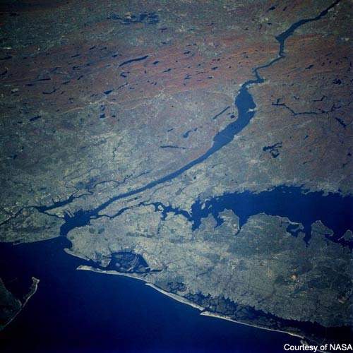
This image of the lower Hudson River emptying into NY-NJ Harbor was taken from the Space Shuttle several years ago (photo credit – NASA). https://www.water-technology.net/wp-content/uploads/sites/28/2017/12/4-new-york-from-space.jpg
NY Waterway is an alphabetical index of items in the “Categories” section. See “Categories” for further descriptions.
Charts (NOAA) – Atlantic Charts and Atlantic Coast Booklet Charts
- Days Points to George Washington Bridge (12341)
- George Washington Bridge to Yonkers (12345)
- Governors Island to 67th Street (Hudson and East Rivers) (12335)
- Lower Bay(12402)
- New York Harbor (12327)
- New York Harbor and Approaches
- Upper Bay and Narrows (12334)
- Yonkers to Piermont (12346)
Coast Pilot (NOAA)
- Coast Pilot #2
- Chapter 11: New York Harbor and Approaches
- Chapter 12: Hudson River
- Weekly Record of Update
Climate Change
- Impacts of Climate Change in New York
- What happens when the climate changes?
- Already Happening
- Temperature
- Precipitation
- Sea-Level Rise
- Natural Resources
- Future Scenarios
- Temperature
- Precipitation
- Sea-level Rise, Storm Surge, and Flooding
- Climate Change and Health
- Already Happening
- What happens when the climate changes?
Source: New York State Department of Environmental Conservation http://www.dec.ny.gov/energy/94702.html
- Climate Change Program for the Hudson River Estuary
- The primary climate risks identified for this region include increased frequency and severity of:
- Flooding, which can impact our waterfront properties and infrastructure
- Heat waves, which can impact human health and agriculture
- Short-term drought, which can impact our food and water supply
- The primary climate risks identified for this region include increased frequency and severity of:
Source: New York State Department of Environmental Conservation http://www.dec.ny.gov/lands/39786.html
- Climate Change Impacts in New York
- A summary of the threats that climate change poses to the people, businesses and ecosystems of New York
- What New York Can Expect:
- Estimated minimum of 5° F increase in temperature by 2100
- Damage to coastal habitat, property and infrastructure due to sea level rise
- Declining drinking water quality and quantity
- Increased costs to dairy and agricultural farming
- Declining freshwater and saltwater fish populations
- Further degradation in air quality leading to exacerbated unhealthy conditions
- What New York Can Expect:
- A summary of the threats that climate change poses to the people, businesses and ecosystems of New York
Source: The Nature Conservancy, Global Climate Change
http://www.usclimatenetwork.org/resource-database/new_york_factsheet_5.pdf
- Rising Waters – Helping Hudson River Communities Adapt to Climate Change Scenario Planning 2010 – 2030 Final Report
- Executive Summary – Climate Change is already evident in the Hudson Valley — and is predicted to accelerate in the coming years. There is no point trying to sugar-coat it. Most climate scientists expect climate in the Hudson Valley to change dramatically over the course of the coming century. The Rising Waters project aims to strengthen the preparedness and adaptive capacity of the Hudson River Estuary Watershed (HREW) to meet the impacts of future climate change. To help people think about the expected local impacts of climate change — and how the Hudson Valley might prepare for them, the Rising Waters project used scenario planning methodologies, first developed at Royal Dutch Shell. Creating scenarios educates participants on important aspects of complicated problems and helps to build a shared conceptual framework for dialogue leading to potential solutions. Scenarios build adaptive capacity because they build shared group understanding.
Source: The Nature Conservancy, Eastern New York Chapter
- Articles
- Can New York Be Saved in the Era of Global Warming? (July 5, 2016)
Icebreaking Operations
- Summary: This Section contains information related to Ice Operations in the Port of New York and New Jersey, including the Hudson River. It will also have the daily ice reports during the ice season.
Lighthouses
- Ambrose Lightship(LV 87/WAL 512, NY)
- Ambrose Light (ALSN6)
- Jeffrey’s Hook (Little Red Lighthouse)
- Old Orchard Shoal
- Robbins Reef
- Romer Shoal
- Sandy Hook
- Statue of Liberty
- West Bank
Marinas
- Brooklyn Bridge Park Marina
- Chelsea Piers
- Hudson Point Marina
- Liberty Landing
- Lincoln Harbor
- Newport Marina
- North Cove Marina
- Pier 25: Moorings, Hudson River Park
- Pier 40: Moorings, Hudson River Park
- Port Imperial
- Shipyard Marina (Hoboken, NJ)
- West 79th Street Boat Basin
Marine Life
Marine life of New York Harbor.
New Jersey State Police Boating Safety Manual
https://northriversailny.wordpress.com/2015/01/11/new-jersey-state-police-boating-safety-manual
The New York City Downtown Boathouse (Kayaking)
The Downtown Boathouse is an all volunteer-run nonprofit organization dedicated to providing free access to the harbor in New York City through public kayaking programs.
http://www.downtownboathouse.org
New York Cruise Ship Schedule
http://www.cruisetimetables.com/cruises-from-new-york-city-new-york.html
http://www.nycruise.com/schedule
New York Harbor
https://northriversailny.wordpress.com/2015/03/08/new-york-harbor
North River (Hudson River)
http://en.wikipedia.org/wiki/North_River_%28Hudson_River%29
New York/New Jersey Harbor PORTS
http://www.co-ops.nos.noaa.gov/ports/index.shtml?port=ny
Safe Boating in the Hudson River and New York Bay
http://www.safeboatingcampaign.com
http://www.safeboatingcouncil.org
Safe Boating Council’s Safe Boating Campaign
http://www.safeboatingcampaign.com
http://www.safeboatingcouncil.org
Sandy Hook Pilots Association
http://www.sandyhookpilots.com
Tides and Currents
- New York and New Jersey Operational Forecast System (NYOFS)
- Edgewater, NJ
- George Washington Bridge
- The Battery
- Verranzano Narrows
- Weehawken/Union City
USCG – New York (Homeport)

Upper New York Bay, POV Maersk Container Ship, Newark, NJ bound
http://homeport.uscg.mil/newyork
USCG – Notice to Local Mariners, District 5
http://navcen.uscg.gov/?pageName=lnmDistrict®ion=5
Vessels in Port
- Live Ships Map
- Port Details
Water Quality
- New Jersey State Department Of Environmental Protection (“DEP”)
- The NJ State Department of Environmental Protection has an interactive map on its website showing the location of combined sewer overflows to alert kayakers and others about areas to avoid after storms. The map is at http://arcg.is/1OydnSC.
- NYC Department Of Environmental Protection (“DEP”)
- DEP collects and analyzes data from a total of 70 sampling stations harborwide to monitor water conditions and understand how water quality can be improved.
- http://www.nyc.gov/html/dep/html/harborwater/harbor_water_sampling_results.shtml
- Riverkeeper, New York’s Clean Water Advocate
-
Riverkeeper conducts a water quality study aboard the Riverkeeper patrol boat. The primary goal of this ongoing project is to characterize and report on the highly variable conditions of the Hudson River Estuary through testing for sewage indicating microorganisms, oxygen and turbidity levels, and other indicators of water quality.
-
Waterway Access/Activity Sites
- The New York City Downtown Boathouse (Kayaking)
- The Downtown Boathouse is an all volunteer-run nonprofit organization dedicated to providing free access to the harbor in New York City through public kayaking programs. Our mission is to encourage safe public use of harbor waters of New York City and thereby provide residents of this space-constrained city with increased recreational opportunities. We support our operations exclusively through volunteers and with your public donations.
- Source: http://www.downtownboathouse.org
- The Downtown Boathouse is an all volunteer-run nonprofit organization dedicated to providing free access to the harbor in New York City through public kayaking programs. Our mission is to encourage safe public use of harbor waters of New York City and thereby provide residents of this space-constrained city with increased recreational opportunities. We support our operations exclusively through volunteers and with your public donations.
Pier 40 – http://www.downtownboathouse.org/Pier40.html (see Pier 26)
Pier 96 – http://www.downtownboathouse.org/Pier96.html
72nd Street – http://www.downtownboathouse.org/72nd.html
Weather
- Intellicast
- NOAA
- WeatherBug
The Weather Channel
- Weather Underground
- Weather Underground
Webcams
Webcams around New York Harbor
- Ellis Island
- NY Harbor Webcam Amazing Views from the New York Harbor House Bed & Breakfast, Staten Island, New York
- NY Harbor from the Statue of Liberty
- NY Harbor from Statue of Liberty (panorama)
- Port New York (from the Chart House Restaurant, Weehawken, New Jersey)
- Statue of Liberty from Brooklyn
- USS Intrepid
- World Trade Center and NY Harbor from New Jersey
Wind Readings
- Robbins Reef (NOAA) Buoy (Wind Readings)
- Sailflow – New York City and Vicinity:
- Weather Underground
- Wind Alert

Leave a comment